

Historic and picturesque headland
Web: www.nationaltrust.org.uk/visit/cornwall/st-anthony-head
St. Anthony Head is a National Trust property situated at the southernmost tip of the Roseland Peninsula, overlooking the entrance to one of the world's largest natural harbours: Carrick Roads and the estuary of River Fal. It preserves a twin six inch gun battery. It was purchased by the National Trust in 1959.
The battery on St. Anthony Head was constructed in 1897 and was armed throughout both World Wars and finally retired in 1952. During the Second World War, the guns were fitted with overhead covers to act as protection against strafing by enemy aircraft. These were removed when the National Trust bought the site, bringing it more closely to its original form. It is now possibly the best surviving early breech-loading artillery fortress in the United Kingdom.
Below the guns were storage magazines for the shells, and separate cartridges which contained the gunpowder propellant. These were stored in different locations and passed through separate lifts to the gun, only being combined at the last minute. The cartridge store required the use of special shoes and clothes, and a search before entering, to reduce the risk of a spark causing an explosion. The battery was protected against invasion by a ditch surrounding the seaward side with an unclimbed fence inside of this.
In October 1940, the coaster 'Jersey Queen' suffered an aerial attack with machine gun, cannon fire and incendiary bombs on its way though the Irish Sea. Two of the crew were injured but the incendiary bombs slipped off the hull into the sea preventing any major damage. Two days later, she struck an acoustic mine in Cornish waters and sank in Falmouth Bay with the loss of two crew. When the mine detonated, the captain was knocked unconscious but was pulled from the water before he drowned by one of the crew. Despite suffering attacks on two subsequent ships he captained, he survived the war and was awarded an MBE for his service.
The 'Allegrity' was a coastal tanker from Grangemouth. On 13th December 1961 she ran aground at Greeb Point, St. Anthony Head. Re-floated by the tide, drifted and grounded at Veryan Beach. Just over a week later, it capsized and was declared a total loss. Her fourteen crew were saved by the Falmouth lifeboat. The ship was scrapped on the beach with material being brought ashore using metal cables. 800 tonnes of crude oil were spilled in the incident.
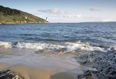
St. Anthony Head Lighthouse was built out of granite in 1835 on the eastern entrance to Falmouth Harbour to guide vessels clear of the Manacles rocks. In most directions, the light is white but a sector close to The Manacles rocks is coloured red, warning vessels to steer offshore. The lighthouse was featured in the UK version of the TV series "Fraggle Rock" as "Fraggle Rock Lighthouse". Until 1954, the lighthouse possessed a huge bell which hung outside the tower and was used as a fog signal. This was later replaced with a foghorn.
The Manacles reef stretches for a mile and a half out to sea and has numerous submerged rocks just below the surface which are all covered at high tide apart from one. The reef has been named "the grave of 1000 ships"; over 100 have certainly been lost here, which is more shipwrecks than any other comparable reef on the south coast of England. The name "Manacles" is thought to be a garbling of Meyn Eglos meaning "church stones" and may either refer to St. Keverne church or the gravestones of over 1000 people who have drowned here. The Wreck Post was erected by the coastguard service to simulate a ship's mast to enable breeches buoy practice.
The proverbial silver lining is that the shipwrecks and surrounding reefs provide a good habitat for marine life and consequently the reef has some of the best diving in Britain. In 2013, The Manacles was designated a Marine Conservation Zone as the wide range of habitats it provides support species such as spiny lobsters and sea fan anemones.
The castle on the headland opposite is St. Mawes Castle. The castle is part of the chain of coastal defences built during the reign of King Henry VIII to protect against an invasion threat from Catholic France and Spain after establishing the Church of England. St. Mawes' clover-leaf shape was designed so that heavy "ship-sinking" guns could be mounted to face in three directions and together with Pendennis Castle could protect the important anchorage of Carrick Roads. Whereas Pendennis Castle was further developed after Tudor times, St. Mawes was not. Thus it is one of the best preserved of these fortresses and is also the most elaborately decorated of them all.
The parish church of St. Anthony was established by the Augustinian Priory of Plympton and was built in 1150 and included a priory alongside, where Place Manor is now located. The site of the former priory is now the site of the house of the Spry family, Place Manor, which was built in 1840 in front of the church. After the dissolution of the monasteries in 1538, part of the priory was used as a residence and other parts were pulled down and the stone was used to build St. Mawes Castle. Despite being extensively restored in the 19th century, the church still retains its original mediaeval plan.
Portscatho St. Anthony Head Lighthouse St. Antony Head Battery
St. Mawes St. Mawes Castle The Roseland Peninsula The Coastal Footpath