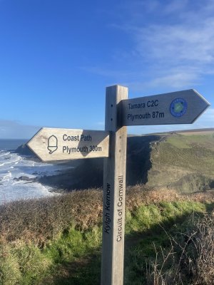
Web: www.tamarvalley-nl.org.uk/discover-explore/walking/tamara-coast-to-coast-way
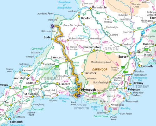
An 87 mile route following the Eastern border of Cornwall
The Tamara Coast to Coast Way links the south coast of Cornwall with the north coast and crosses into Devon on several sections. The Torpoint Ferry is used to cross the River Tamar to Devonport where the route skirts Plymouth. At Tamerton Foliot the Tamar River Discovery Trail is followed to Bere Alston station to make use of the train to Calstock for another crossing of the Tamar. The path passes through Gunnislake to reach Lifton, the end of the Discovery Trail. A section using mostly quiet roads follows before encountering the Bude Canal with its many heritage features. The canal is followed intermittently to reach Lower Tamar Lake, supplying water to the canal, and the modern reservoir of Upper Tamar Lake. The River Tamar is then followed to its source at Wooley Moor. From there the path leads along Marsland Water, marking the boundary between Cornwall and Devon, to the coast at Marsland Mouth. Here the South West Coast Path is picked up to go south to Morwenstow, near Bude.
Begin your adventure in Plymouth, where the river meets the sea, and let the captivating path guide you along the River Tamar's winding course.
Immerse yourself in the Valley’s history and heritage as you encounter remnants of the region’s mining past, charming villages, and ancient landmarks.
The beauty of this walking route lies not only in its scenic splendour but also in the variety of landscapes you will encounter.
As you venture closer to the source of the River Tamar, you will be enveloped in a sense of peaceful seclusion.
Torpoint Calstock Gunnislake Launceston Bude The Tamar Valley
Walks and Walking in Cornwall Cornish Cafes Cornish Pubs