Email: hello@southwestcoastpath.org.uk
Web: www.southwestcoastpath.org.uk
Covering all 272 miles of the Cornish Coast
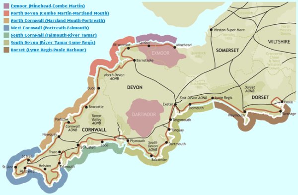
The Cornwall Coast Path is the central portion of the 630 mile South West Peninsula Coast Path, which extends from Minehead in Somerset to South Haven Point beside Poole Harbour in Dorset. The walker enters Cornwall in the north by a small plank footbridge across the little stream at Marsland Mouth in the wild country between Bude and Hartland Point and leaves it 272 miles later by a ferry across the deep channel between Cremyll, at Mount Edgcumbe and Plymouth Sound. This is the mouth of the River Tamar which, rising only four miles west of the start of the path, serves, for most of its length, to divide Cornwall from Devon.
The South West Coast Path is unusual in that it is based on a route which was in use as a working footpath until comparatively modern times. Coastguards used to patrol the whole coastline of the South West Peninsula on foot, every day, in the course of their duties, initially primarily of Revenue protection against smuggling and wrecking but later also in pursuit of maritime safety. This coastguard work continued until 1856 and was continued by the Admiralty until 1913. It was the essence of their job that the coastguards literally had to see into every cove and inlet on the coast. This meant that their well-beaten path, often punctuated with stone stiles, had to hug the cliff top, so providing the splendidly scenic views the Coast Path enjoys today. Not only the coastguards but their children going to and from school, their wives walking between one fishing hamlet and the next, all used these coastal paths, building up a considerable body of usage. Over its length it now offers views, unparalleled for their extent and scenic quality, which have come about simply from this working origin.
Most of the path is in the Cornwall Area of Outstanding Natural Beauty, and it is proposed that much of this coastline should be defined as Heritage Coast because of its outstanding scenic qualities. It has been the aim and policy of the Countryside Commission and Cornwall County Council that the coastal footpath around Cornwall should follow the cliff edge as near as possible within reasonable safety and that roads should be used only where necessary. The final section of the path was designated as a National Trail in 1978.
Cornwall's varying coastline provides contrasting conditions from sheer awe-inspiring cliffs windswept by Atlantic gales on the north coast, to the mellowness of the south coast. It is a footpath with sections suitable for the elderly walker, the four miler's and the strong enthusiastic walker. To assist in the choice of section to suit the mood, details of the footpath, walking conditions, availability of facilities, car parking and access points along the footpath, also the approximate mileage between sections around the coast, beginning at Marsland Mouth, have been summarised for the whole 272 miles.
Marsland Mouth, North Cornwall, to Bude - 9 miles
Access to the coastal footpath at Marsland Mouth is obtained from the County highway north of Marsland Farm by public footpaths on the south side of the valley. The coastal footpath follows the cliff edge and the walker is immediately aware of the might of the Atlantic by the sheerness of the cliffs and scarcity of trees. A short distance inland is the village of Morwenstow. Soon after this the hut of the eccentric Reverend R S Hawker is found, this is where he wrote his poems etc. in solitude. It is a remote area, the hilly terrain making it a tiring section to walk until nearing Bude. This is a resort of considerable character with its canal, river, sandy beaches, grass downs, a sea pool, an historic breakwater and pine trees adding to the setting.
Bude to Crackington Haven - 10 miles
After crossing the Bude Canal by the road bridge or lock gates the footpath continues round Compass Point and along the cliffs to Widemouth Bay with its beautiful sandy beach. To Millook the going is pleasant but from there to St. Gennys high on the cliffs and Crackington Haven in the cove, there are steep valleys and water courses which make it a tiring section, but the cliff scenery is worth it.
Crackington Haven to Tintagel - 11 miles
From the beach the footpath rises 300 feet to Cambeak Point then along the top of the Strangles, a remote area of broken cliffs of high amenity value. It is a tough and tiring section and walkers might consider taking with them some form of sustenance, the nearest refreshment facilities being at Boscastle. The footpath continues along the south side of the harbour over Forrabury Common and along Trevalga Cliff to Rocky Valley, a beauty spot with a path up to St. Nectan's Glen, passing above Bossiney Cove. Then on to Tintagel, the legend of King Arthur and his Castle on Tintagel Island. The ruins of the monastery, St. Juletta's Chapel and Iron Gate on the Island are of considerable interest. The monastic settlement probably dates back as far as A.D. 350. Another monument well worth visiting is the Old Post Office, a 14th century building in the centre of Tintagel.
Tintagel to Port Isaac - 7 miles
After climbing to St. Materiana Church the walking conditions along Glebe Cliff to Trebarwith Strand are pleasant. At the Strand the contorted rocks on a beautiful sandy beach plus nearby facilities invite the walker to stay awhile to appreciate its beauty. Not to be missed is the sheer granite cliff face above Port William. From behind the Inn in the Cove the footpath zig-zags up the cliff to a height of 300 feet, descends into Backways Cove; rises sharply to Start Point and then along Treligga Cliff where the going is easier to "The Mountain". From here to Port Gaverne the cliff and coastal scenery is outstanding in its beauty; the indentations made by the Atlantic rollers are evidence of the Ocean's might. Both botanist and bird watcher should also find great interest here. From Port Gaverne to the car park at Port Isaac the highway is used.
Port Isaac to Padstow - 10 miles
Leaving the Haven at Port Isaac the footpath is along the cliff to Start Point descending into the small cove of Pine Haven. Here the coastal footpath takes a turn inland up the valley towards Roscarrock and across fields away from the cliff edge to Port Quin. The walker may appreciate this easy two miles after the arduous walking conditions from Marsland Mouth. He will be attracted to Doyden Castle on the Point and a little further on listen to the surge of the Atlantic 100 feet below where the footpath passes the old mine shafts. A pleasant path passes around Lundy Bay with its tiny sandy beach. Carnweather Point leads on to the cliff castle at Rumps Point. Then on to Pentire Point with its fine views up and down the coast before dropping down to Polzeath where the bathing is safe and all facilities can be found. From here to Rock the going is easier, the walker having a choice of footpaths round Brea Hill to the ferry stage at Rock before crossing the Camel Estuary at the mouth of the River Camel to Padstow.
Padstow to Porthcothan - 14 miles
The coastal footpath commences on the north side of Padstow Harbour and continues along the edge of the Camel Estuary to Stepper Point. The golden sands of the estuary and the visual aspect of small boat activity make this an enjoyable walk. The terrain is now less severe making the conditions for walking good, and passing Trevone Bay. At Harlyn Bay the beach is used for a short distance before continuing at the edge of fields past Mother Ivey's Bay and the lifeboat station to Trevose Head with its Lighthouse. The village of St. Merryn with its shops etc. is a short distance inland. From here to Constantine Bay, Treyarnon Beach, Porthcothan Beach is fine cliff-top walking.
Porthcothan to Newquay - 10 miles
The path out of Porthcothan climbs graduallly up to Park Head, then above Bedruthan Steps along National Trust land and down to the sandy beach at Mawgan Porth the scenery is delightful and walking conditions allow for a good mileage to be covered. Refreshments can be obtained at these places and there is a cafe at Bedruthan Steps. From Mawgan Porth the cliffs become higher and across Watergate Bay can be seen Towan Head and Newquay. For a short distance after leaving St. Columb Porth, which is a popular family bathing beach, the footpath follows the north side of the Porth and then on to the road until the Barrowfields and finally into Newquay. This is one of Cornwall's largest holiday resorts, with extensive sandy beaches, surfing, majestic cliff scenery, gardens and entertainments.
Newquay to Perranporth - 12 miles
From Newquay Harbour the coastal footpath is around Towan Head, along Fistral Sands out to Pentire and the ferry across the Gannel to Crantock Beach. At low water the river can be crossed by footbridge near Trethellan. A small detour inland to visit the church and village of Crantock might be made before continuing to Pentire Point, Porth Joke and Holywell. Fantastic views of the seabirds around the offshore twin pyramids of Carter's Rocks await around the next headland as you approach the dunes of Holywell and Perran Sands and St. Piran's Oratory. Walking across the dunes can be quite tiring, but if the tide is right out you can walk to Perranporth across the beach and visit the caves and workings of the old tin mines. All facilities are available at Perranporth which is another popular resort for surfing, its three miles of wide sandy beach and sheer cliffs as forbidding as any along the Cornish coast.
Perranporth to Portreath - 11 miles
Leave Perranporth by using the road up to the Droskyn Hotel passing this on the landward side to a wide and defined footpath halfway up the cliff side. For the next three miles there is evidence of past tin mining. The coastal footpath winds down into Trevaunance Cove and St. Agnes where refreshments can be obtained, then continues along the cliffs to St. Agnes Head and down to Chapel Porth where there is a cafe and toilets. From the Porth the cliffs rise 200 feet and the footpath continues along their edge until reaching Porthtowan. Again there is evidence of past mining activity but the walking conditions are good. From here to Portreath walking conditions are pleasant. Sheer rock faces, and indentations caused by coastal erosion with the blue Atlantic Ocean always below make this coast particularly interesting. Portreath is a small seaside resort with a harbour, beach and usual facilities.
Portreath to St. Ives - 14 miles
After climbing Tregea Hill out of Portreath the coastal footpath continues along the cliffs to Carvannel Downs where a slight diversion may be necessary above Porth Cadjack Cove during very wet weather. The scenery now is superb and the walking conditions good. The walker cannot resist a cautious look down the cliff at Hells Mouth or fail to stop a moment to appreciate the setting and beauty of St. Ives Bay as he approaches Godrevy Lighthouse and Gwithian. At Godrevy Point the cliffs give way to sand dunes with a three mile stretch of sandy beach attractive to visitors and local inhabitants. There is a pub (The Sandsifter) here right on the path. Keeping to the edge of Hayle Towan and passing the chalets the walker should make for the old Hayle Power Station where there is an on-call ferry across the River Hayle. If this is not operating a detour of three miles is necessary through Phillack, Hayle to Lelant, Make for St. Uny's Church where there is a choice of footpaths across the Golf Course or along the side of the railway line above Porth Kidney Sands to Carbis Bay. The coastal footpath continues to Porthminster Beach, and joins the main road into St. Ives. The old town with its harbour narrow streets, artists' studios, galleries and potteries make it a fascinating resort. The golden sand of the beaches, remote stretches of cliffs and moorlands to the west, are attractive to the walker who might try a pleasant inland walk over Rosewall Hill covered with bracken and gorse.
St. Ives to Cape Cornwall - 14 miles
From the western end of Porthmeor Beach in St. Ives, where the town development ends, the walker is soon in open country as remote as any stretch of coast in the County. Sheer rugged cliffs, deep indentations above small coves, rising moorland behind and the blue of the Atlantic provide great scenic beauty. Along Hellesveor Cliff small detours are made round springs and bog areas but the coastal footpath follows the cliff edge as near as possible. Arriving at Zennor Head the walker might consider visiting the ancient church at Zennor opposite The Tinners Arms, or continue for a mile and a half to Gurnards Head and obtain refreshment at the hotel at The Gurnards Head at Treen. From here past Morvah and onto Pendeen, the going is tough but beautiful. The lonely Pendeen Lighthouse sits on the headland here. From Pendeen through Botallack to Cape Cornwall there is plenty of evidence that it was once an important tin mining area with Botallack Mine, Geevor Mine and Levant Mine which were all very prosperous in their day, but the scars have become covered with gorse, heath and bracken and the walking conditions are pleasant. Just a couple of miles inland from here is the village of St. Just.
Cape Cornwall to Land's End - 6 miles
Beyond Cape Cornwall walking conditions become easier and Sennen Cove is soon reached passing The Old Success Inn. It is an unspoilt small village with a harbour, glorious sandy beach, and all facilities. Leaving the Cove the coastal footpath climbs to the Signal Station on Pedn-men-du Point and from here to Land's End the conditions, and scenery are delightful. Land's End is perhaps unique in being the most westerly point in England, the rock formations and colours of the cliffs attracting the photographer whilst out to sea is the famous Longships Lighthouse. All facilities including a post office are to be found here.
Land's End to Penzance - 15 miles
Soon after leaving Land's End, the cliffs become less awesome, there are more accessible beaches and coves and the coastal footpath is less winding. Walking conditions past Gwennap Head to Porthcurno through the little cove of Porthgwarra, are excellent and the landscape unsurpassed, passing by the famous Minack Theatre. From Penberth Cove to Porthguarnon the coastal footpath is signposted round Burnewhall Cliff and again at Porthguarnon where the footpath zig-zags to the top of Trevadran Cliff. The coastal footpath runs behind an isolated house, St. Dellan at St. Loy descending to the Cove before climbing to Boskenna Cliff. It then winds between outcrops of rock along Boscawen and Rosemodress Cliffs where the author Derek Tangye lived in his flower farm, then passes the Tater Du Lighthouse and down to Lamorna Cove with its granite quarries and a welcome cafe, where the stream is crossed by a footbridge. The coastal footpath can be seen winding its way up Kemyal Cliff through bracken and rocky outcrops to Carn-du-Point. From here to Mousehole the cliff side is broken by numerous small flower growing enclosures until the coastal footpath reaches the highway into Mousehole. Its harbour is perhaps the village's main attraction but it is worthwhile exploring the narrow streets and looking down on what must be one of the most fascinating house roof-scapes in the Country. From Mousehole the highway is used through the fishing port of Newlyn, and along the promenade passing the Jubilee Pool, then into Penzance which is the terminus for the railway as well as many bus routes.
Penzance to Porthleven - 13 miles
Leave Penzance by road past the station to Chyandour where there is a railway under-bridge giving access to the foreshore passing a pub (The Station House) right on the path. The coastal footpath is on land above high water mark entering Marazion opposite St. Michael's Mount which is famous for its setting and beauty. Out of Marazion the main road is used for a short distance past the chapel where a narrow road and steps give access to the beach, or further along to the cemetery where there is a wide footpath to the foreshore. The coastal footpath is along the beach as far as Venton Farm. From here to Perranuthnoe the footpath varies from either following the beach or croft land. The going now to Prussia Cove once the haunt of John Carter the notorious smuggler, and Praa Sands is good, the cliffs less steep and the landscape more mellow. At Praa Sands refreshment and toilet facilities are available. After crossing Praa Green the road is used to the foot of Rinsey Head crossing the neck of the headland on the landward side of the house on the point. From here into Porthleven walking conditions are good.
Porthleven to The Lizard - 13 miles
Porthleven is a fishing village with an inner and outer harbour which is its main attraction. The Ship Inn here has excellent views. From the eastern end of the harbour the road is used as far as Gravesend after which there is a roughly metalled road to the Bar at Loe Pool, part of the Penrose Estate. Crossing the pebbled Bar the coastal footpath continues along the coast with good walking conditions to Church Cove. The small isolated church is now threatened by coastal erosion. After crossing the stream Poldhu Cove is soon reached. The footpath passes in front of the Poldhu Hotel on the Point, then on to Polurrian Cove and Mullion Cove. The harbour and islands of rock are most attractive. The footpath over Predannack Cliffs is well used and the 200 foot high cliffs remind the walker of some of the tough sections on the north coast. Good walking conditions continue to Kynance Cove which is a beauty spot noted for its serpentine rock cliffs and sandy beach. After a steady climb, Lizard Point is reached. A short detour can be made up the road to Lizard Village where their are shops and pubs for refreshments.
The Lizard to Coverack - 10 miles
The coastal footpath passes to the seaward side of the Lizard Lighthouse out to Housel Cove then up over Pen Olver Point to Church Cove at Landewednack. The walking conditions are good and the coastal scenery outstanding to the Devil's Frying Pan, a unique feature, at Cadgwith. Cadgwith itself is a small fishing village with some picturesque thatched cottages and the Cadgwith Cove Inn. The footpath continues along the coast to Poltesco, Kennack Towans with its beautiful beach, on over Eastern Cliff skirting Lankidden Cove and headland to Black Head and enters Coverack above Penprean Cove. A most satisfying and enjoyable stretch of coast.
Coverack to Helford - 11 miles
Leaving Dollar Point the road is used above Coverack Cove until reaching North Corner where the footpath starts along the coast. Soon after reaching Lowland Point active quarrying works are passed by before dropping down to Porthoustock, after which there is an inland diversion to reach Porthallow. This section has very little to commend it to the walker but the footpath is continuous and immediately after leaving Porthallow the conditions and scenery improve to Nare Point, round to Gillan Cove, and Flushing Cove. At low water during the summer months the delightful Gillan Creek can be crossed by stepping stone, or there is an on-call ferry across to St. Antony. The coastal footpath continues round Dennis Head to Ponsence Cove and through the woodland beside the estuary to Helford Village where refreshment and other facilities are available.
Helford to Falmouth and St. Mawes - 11 miles
From the end of Helford village there is a wide footpath out to Helford Point and the ferry stage to Helford Passage. The scenery now is superb and the yachts and small boats provide much interest. A pint at the inn before starting for Falmouth might be welcome. The coastal footpath is along the north side of the Helford River to Rosemullion Head before turning north to Maenporth with its delightful sandy beach and setting. From Helford the going has been good and these conditions continue to Swanpool along the water front at Falmouth and to Pendennis Point dominated by Pendennis Castle which provides interest at the approach to Falmouth's deep water harbour. Castle Drive is now used and the walker may stop for a brief moment to look down at the ship-repairing docks, out across to Flushing and St. Mawes before continuing to the centre of Falmouth and the Prince of Wales Pier for the ferry across the River Fal to St. Mawes. The approach to St. Mawes by sea is outstanding for its beautiful setting and the view towards St. Mawes Castle.
St. Mawes to Portloe - 12 miles
The same ferry links St. Mawes with Place Manor on the Roseland Peninsula, and the walker should enquire about times of sailing. A visit to the private chapel in the manor and the old church should not be missed. The coastal footpath is along the estuary and to St. Anthony Head Lighthouse, round Zone Point on St. Anthony Head, passing St. Antony Battery and across the head of Towan Beach before following the coast to Porthscatho where refreshment and other facilities are available. Leave the village by a road running for a short distance between houses at the end of which a well used footpath continues along the coast to Porthcurnick Beach. From here it is good walking to Pendower Beach with a gentle climb to Nare Head where the cliff scenery is outstanding to Portloe which is a remote little fishing village unspoilt by change.
Portloe to Mevagissey - 11 miles
Leave Portloe by steps leading to the Point and then passing to the rear of the coastguard station the footpath continues along the coast to West and East Portholland. From East Portholland the footpath doubles back on itself keeping slightly away from the cliff edge until reaching Porthluney Cove, a popular bathing beach with a background of Caerhays Castle and woodlands making the setting outstanding in its beauty. Walking conditions are still good but after a mile to Greeb Point where there is a newly completed section before arriving at Hemmick Beach. From here the conditions are good to Dodman Point; the path then goes down to Gorran Haven where facilities are available. From here the footpath follows the road from the beach between houses, the coastal footpath continuing at the edge of fields on the landward side of development as far as Great Perhaven Point where it turns along the cliffs out to Chapel Point and Portmellon Cove. Mevagissey is approached by road; steps leading from the harbour pier may be used from Stackums Point or there is a narrow road down to the village centre. Mevagissey is one of Cornwall's most thriving fishing villages, as witness the number of seagulls and has both inner and outer harbours.
Mevagissey to Par Green - 9 miles
The coastal footpath leaves Mevagissey at the northern side of the harbour, follows a narrow road at a higher level and after a short distance the footpath along the cliffs is reached. After approximately one and a half miles, just before reaching Pentewan Beach, the footpath joins the main road. This is used to reach Pentewan Village and harbour. After leaving the village by road, the walker takes a sharp right turn onto the path past the chapel leading out to Hallane up a steep path to Black Head, which used to be a firing range, but the footpath is well defined to Trenarren House, once the home of the author Dr Alfred Leslie Rowse. There is a well worn footpath to Porthpean following the coast to Duporth beach then on to Charlestown Harbour which was built by Charles Rashleigh for the china clay industry. From the northern side of the harbour is a well defined footpath between houses and the cliff edge round to Crinnis Beach at Carlyon Bay. The town of St. Austell with all its services is only a mile inland from here. A short distance after leaving the Golf Course, further access along the coast is stopped by the China Clay Docks and development so it is necessary at Spit Point to cross under the railway to the main road leading to Par Green.
Par Green to Fowey - 6 miles
After crossing over and under the railway, the road is taken along Par Green then turning right onto the path leading back to the beach. Between the sands and the caravan park is a path to Polmear and the Ship Inn. The path then crosses a small stream and climbs back onto the low cliffs before dropping down many steps to Polkerris. This is a typical small Cornish village with a harbour, The Rashleigh Inn and toilets at the end of a single road through a well-wooded valley. The coastal footpath zig-zags up through the woods from the cove. The going is good to Gribbin Head, distinguishable by the red and white ringed tower on top. The scenery and setting is now superb with walking conditions good all the way into Fowey. After dropping down from the headland the beautiful setting of Polridmouth which is part of the Menabilly Estate once the home of Daphne du Maurier, is passed before arriving at St. Catherine's Point at the entrance to Fowey Harbour, the walker cannot resist stopping at the ruined St. Catherine's Castle to look across to Polruan or at Readymoney Cove below. The footpath from the Point descends through woodlands to the Cove from where the road is used to the ferry halfway along the Esplanade and into Fowey. The narrow streets, town quay and church, together with the activities in the harbour make the town most attractive.
Polruan to Looe - 11 miles
There is a regular ferry service across the Fowey River to Polruan. From the quay passing the Lugger Inn the way goes down West Street passing the Russell Inn almost to the Blockhouse ruin on the point. The road is also used up to the Coastguard Station before the footpath is sign posted along cliffs above Polruan village. The walking conditions are now good around Lantic Bay and Pencarrow Head, across the cliffs all the way to Polperro. The village with its harbour and narrow streets is a great tourists' attraction. Commencing at Polperro harbour, the coastal footpath rises to the top of Dennisball Hill and passing the path down to Polperro Lighthouse, clearly following the cliffs to Talland Bay. Here it crosses the back of the beach using the road, past the toilets and turns sharply right. At this point the footpath is sign posted across the fields and over the cliffs to join the road at Hannafore into Looe. The harbour, fishing boats, narrow streets and rivers make Looe a most attractive holiday resort and, like Polperro, a great tourist attraction.
Looe to Portwrinkle - 7 miles
The footpath starts by steps off the Esplanade at East Looe and climbs a narrow lane past some bungalows at Plaidy then down through some trees to Millendreath Beach. From the far side of Millendreath Beach a path leaves the road and runs parallel with the coast through the trees past Bodigga Farm and on the seaward side of Windsworth and Murrayton, where there is a monkey sanctuary, and rejoins the road dropping down to Seaton. From Seaton either the beach or road may be used to Downderry. At the eastern end of the village, at Battle Gate, the coastal footpath crosses fields for about one mile above Battern Cliff to its junction with the road to Crafthole. Before reaching Crafthole use the lane leading to Portwrinkle on the coast.
Portwrinkle to Cremyll - 13 miles
At the eastern end of Portwrinkle almost opposite the Whitsand Bay Hotel, the coastal footpath again follows the cliffs but only for about one mile before rejoining the road because of the rifle-firing ranges at Tregantle Fort. After passing the Fort the road along the coast must be used owing to hundreds of chalets along Withnoe and Ninney Cliffs above Whitsand Bay. After approximately three miles and the last chalet is passed, the coastal footpath leaves the road down gently sloping cliffs to Polhawn Cottages, passing on the landward side to a swing gate. Crossing over the access road leading to Polhawn Fort the path follows the steps on the other side climbing up to the Church Ruin at Rame Head, where on a clear day the Eddystone Lighthouse may be seen eight miles to the south. From here the coastal footpath is well defined to Penlee Point where the way is over a metalled road through woodlands to Cawsand .The villages of Cawsand and Kingsand are virtually one, the Cornish character of which is unchanged and the setting delightful. From the eastern end of Kingsand, several footpaths cross the fields to Hooe Lake Cottage or the flat worn rocks can be used as far as Sandway Cellar before leaving the fore shore. The coastal footpath crosses the drive to Picklecumbe Fort into the Mount Edgcumbe Country Park where the walker can wander at his pleasure or press on using the metalled drive above the fort, along the eastern side of the park to the lodge gates at Cremyll. The natural scenery of the park is excellent and the walker could pleasantly spend an hour walking through the formal garden to see the Orangery, Italian gardens, monuments, the English garden and its cork trees, the French garden and enjoy the pleasure of winding paths and panoramic vistas. Refreshments and toilets are available at the Orangery and there is a cosy little inn round the corner opposite the ferry stage, (The Edgcumbe Arms). The ferry leaves Cremyll, and Cornwall, crossing Plymouth Sound on the River Tamar to Plymouth, which completes the 272 miles from Marsland Mouth.


Tamara Way The National Trust in Cornwall Walks and Walking in Cornwall Youth Hostels Association
Cornwall's Beaches Cornwall's Ferrys Cornish Cafes Cornish Pubs The National Coastwatch Institution